A few days ago I was talking to my good friend Raphael Savina and he made a feature request:
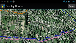
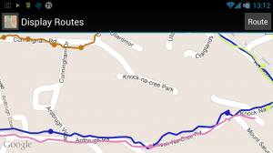
Raphael wanted to be able to view his Routes against a satellite image instead of a map.
I had already discovered that you could easily turn satellite images on and off with this code:
MapView.setSatellite(true/false);
So I made a deal with Raphael: if he would draw me a satellite I would write the code and get the version up ASAP.
Raphael promptly supplied me with a lovely drawing of a satellite and I made the necessary changes to DisplayRouteActivity and displayroutes.xml to turn the icon in the titlebar of Display Routes into a functional button.
And the result is Version 0.0.10 of Shortest Walking Route.
Note:
I’ve edited all of my icons to better fit into the Menu Icon Guidelines, which has resulted in the application icon going from being slightly bigger than it should be to slightly smaller.
What’s Next:
- Adding a Target function so you can tell Shortest Walking Route where you are going and have it terminate the gps capture when you get there.
- Tuning down the number of GPS fixes captured to more efficiently represent a route.
- Finding more useful information about routes to display
Tags: android, maps, MapView, route, satellite, short, walking

 April 13th, 2012
 Posted in
